


About Asuka Fujiwara
Introduction of component parts
Palace and government office sites
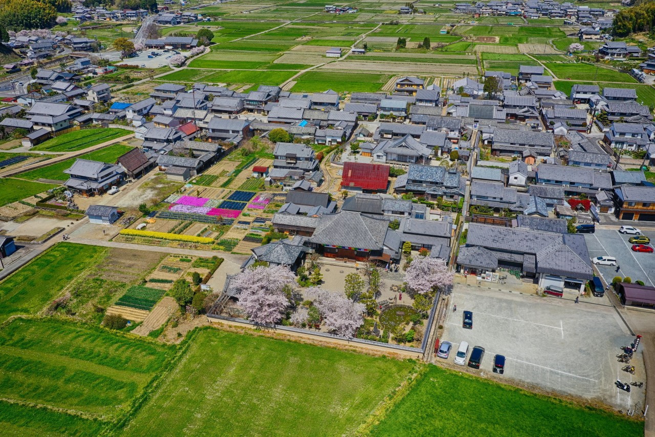
01 Asuka Palace Site
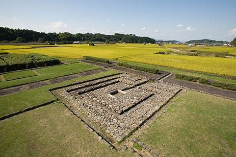
The Asuka Palace Site is the remains of four palaces constructed in the 7th century: Asuka Okamoto-no-miya Palace, Asuka Itabuki-no-miya Palace, Nochi-no-Asuka Okamoto-no-miya Palace, and Asuka Kiyomihara-no-miya Palace. From the layout of the buildings, it is known that the palace was a place for official ceremonies and government affairs and a private residence. Government offices were dispersed inside and outside the palace and were not centralized within the palace. Asuka Palace was built as Okamoto-no-Miya by Emperor Jomei, who succeeded Emperor Suiko in 630. The palaces of successive emperors were located there for four periods: Itabuki-no-Miya, Nochi-no-Okamoto-no-Miya, and Kiyomihara-no-Miya. It was also the scene of many events in Japan’s ancient history, such as the defeat of Soga-no Iruka by Prince Naka-no-Oe-no-Miko and others in the “Isshi Incident” of 645.
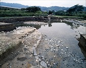
02 Asuka Pond Garden Site
- 所在地
- Oaza Oka, Asuka Village
- 指定年月日
- August 27, 2003 (Historic Site and Place of Scenic Beauty)
- 航空写真で見る
- Google Maps
Asuka Pond Garden Site is located northwest of the Asuka Palace Site, and is the site of a garden attached to the Asuka Palace. It was created in the middle of the 7th century during the reign of Emperor Saimei and was used as a garden attached to the palace until the Asuka Kiyomihara-no-miya Palace (672-694) of Emperor Temmu and Empress Jito. The garden pond is separated from the Minami-ike and Hoki-ike by a central dike, but they are connected by a wooden flume buried in the dike, allowing water to flow from the South Pond to the North Pond. The stone revetment, which is also paved with stones at the bottom, was placed with highly artistic stone structures such as a water conducting facility, a fountain facility, and a huge stone tank. Gardens attached to palaces have been confirmed not only in China but also on the Korean peninsula, and some similarities between Asuka Pond Garden Site and those on the Korean peninsula can be recognized, indicating that the landscaping techniques were introduced by the visitors to Japan. On the other hand, some of the designs and structures are unique to Japan, and the Asuka Pond Garden Site is significant as the earliest example of a garden that led to later Japanese gardens.
03 Asuka Water Clock Site
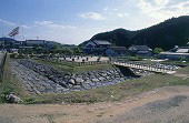
Asuka Water Clock Site are the remains of the oldest water clock tower in Japan, built in 660. It is located on a flat area along the Asuka River at the eastern foot of Amagashi Hill. It consisted of a stone-plastered platform surrounded by a moat and a full-pillared building built on top of it, with a wooden gutter running inside the platform, and a lacquered wooden box set in the center of the platform. The results of the investigation of this unprecedented structure revealed that it was a “rōkoku-dai,” a platform for telling the time. It is assumed to be a staircase-shaped rōkoku, in which water flowed from the uppermost water tank to the lowest receiving tank, and the time was measured by the rising scale on the lowest level and is thought to have been introduced and installed from Tang China. These remains were abandoned in the latter half of the 7th century, and it is believed that the funicular was moved from Asuka to Otsu with the relocation of the palace to Omi Otsu-no-miya.
04 Sakafuneishi Ritual Site
- 所在地
- Oaza Oka, Asuka Village
- 指定年月日
- April 8, 1927 (Historic Site)
- 航空写真で見る
- Google Maps
- Webサイト
- Sakafuneishi (Asuka Village)
The Sakafuneishi Ritual Site is a ritual site built in the middle of the 7th century that shows the religious aspect of state formation. It is located on a hill northeast of the Asuka Palace Site. There is a stone wall surrounding the hillside, a Sakafuneishi on the hillside, a turtle-shaped stone tank at the foot of the hillside, and a spring facility that conducts spring water from underground to the surface. Before the discovery of the spring water facility, the use of the Sakafuneishi was shrouded in mystery and various theories were proposed, such as brewing sake, but with the discovery of the spring water facility, it is now assumed that the structure and location of the site were the remains of state rituals by the emperor. Although the facility incorporated new technology, it is believed to have inherited the character of water rituals that had been practiced since the Kofun period and can be considered a site that demonstrates the fusion of traditional Japanese culture and foreign technology.
13 Fujiwara Palace Site, Fujiwara-kyo Suzaku Oji Ruins
- 所在地
- Takadono-cho, Bessho-machi, Daigo-machi, Kashihara City, Kashihara, etc.
- 指定年月日
-
November 21, 1946 (Fujiwara Palace Site: Historic Site)
March 29, 1952 (Fujiwara Palace Site: Special Historic Site)
October 4, 1978 (Fujiwara-kyo Jubilee Road Ruins: Historic Site)
- 航空写真で見る
- Google Maps
The Fujiwara Palace Site attest to the birth of a centralized state based on the “Ritsuryo” system in Japan through political and cultural exchanges with the Sui and Tang Dynasties (China) and the Koguryo, Silla, and Baekje Dynasties (Korea). The palace was about 1 km square. The approximately 1 km square palace was the embodiment of the centralized power system centering on the emperor, and included the emperor’s living quarters as well as spaces for government affairs, ceremonies, and government offices. Surrounding the palace was the Fujiwara Palace, a about 5 km square capital city where officials resided. The urban planning of the palace also shows a significant development from the Asuka Palace, with two official temples (Daikandaiji-Temple and Motoyakushiji-Temple), symbolizing the Buddhist state of protection, located to the south of the Fujiwara Palace, and the emperor’s mausoleum and tombs located directly south of the palace in the south outside of the palace. This structure of palace and capital city also served as a prototype for the later Heijo-kyo and Heian-kyo palaces. The Fujiwara-kyo capital was moved to Heijo-kyo in 710, and the main buildings were dismantled and relocated. It is said that the Daigoku-den Hall of Heijo-kyo Palace was also moved from Fujiwara Palace.
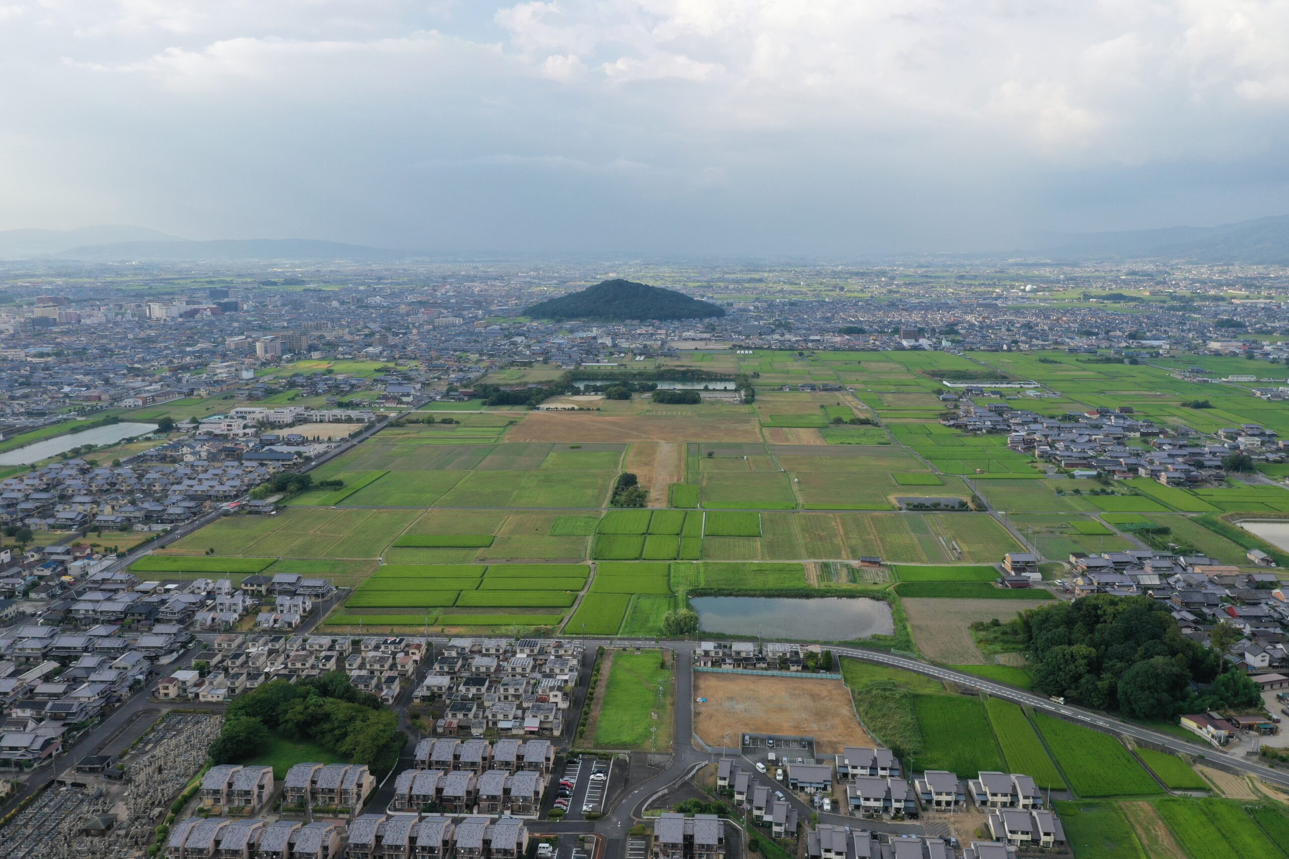
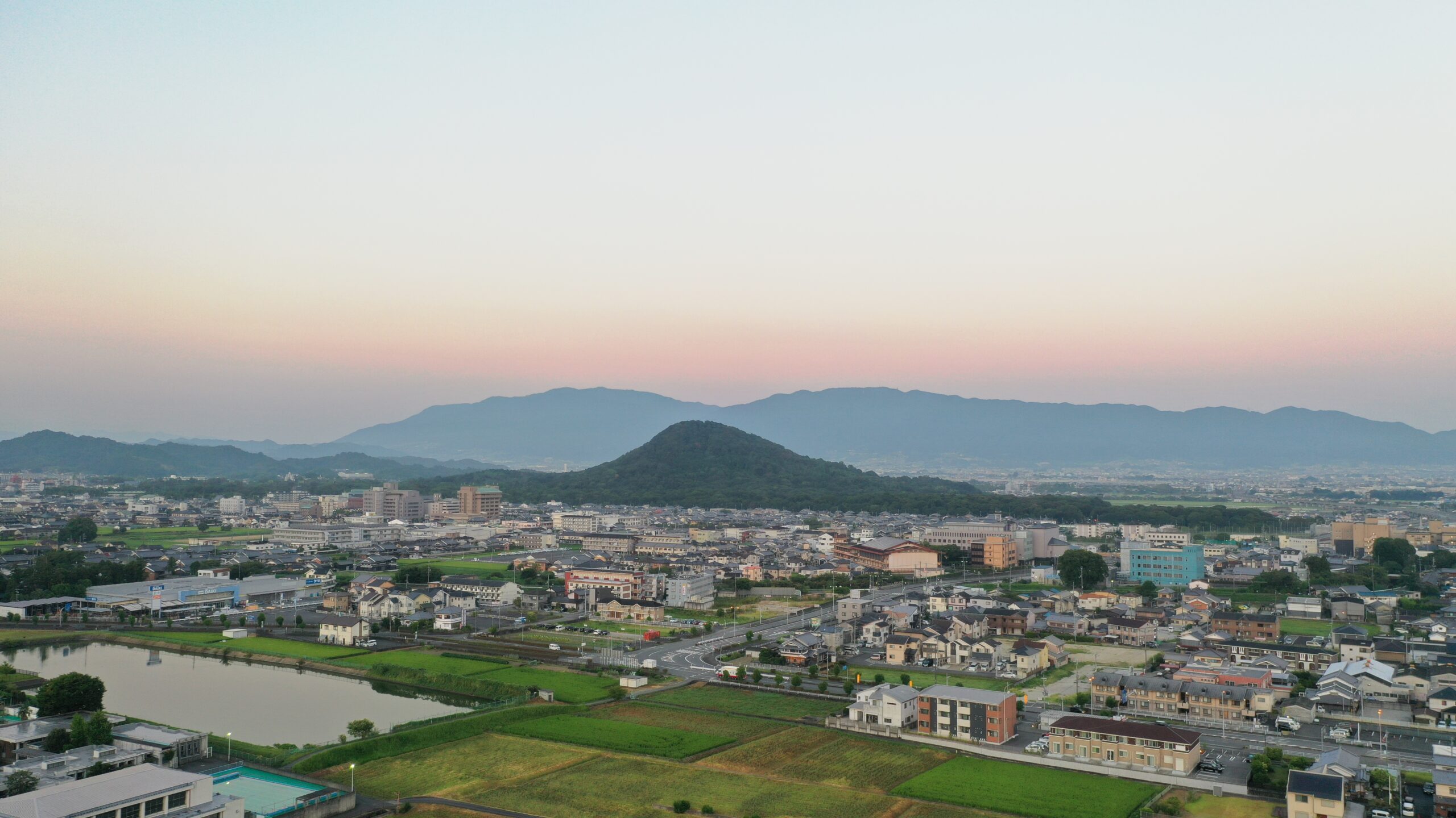
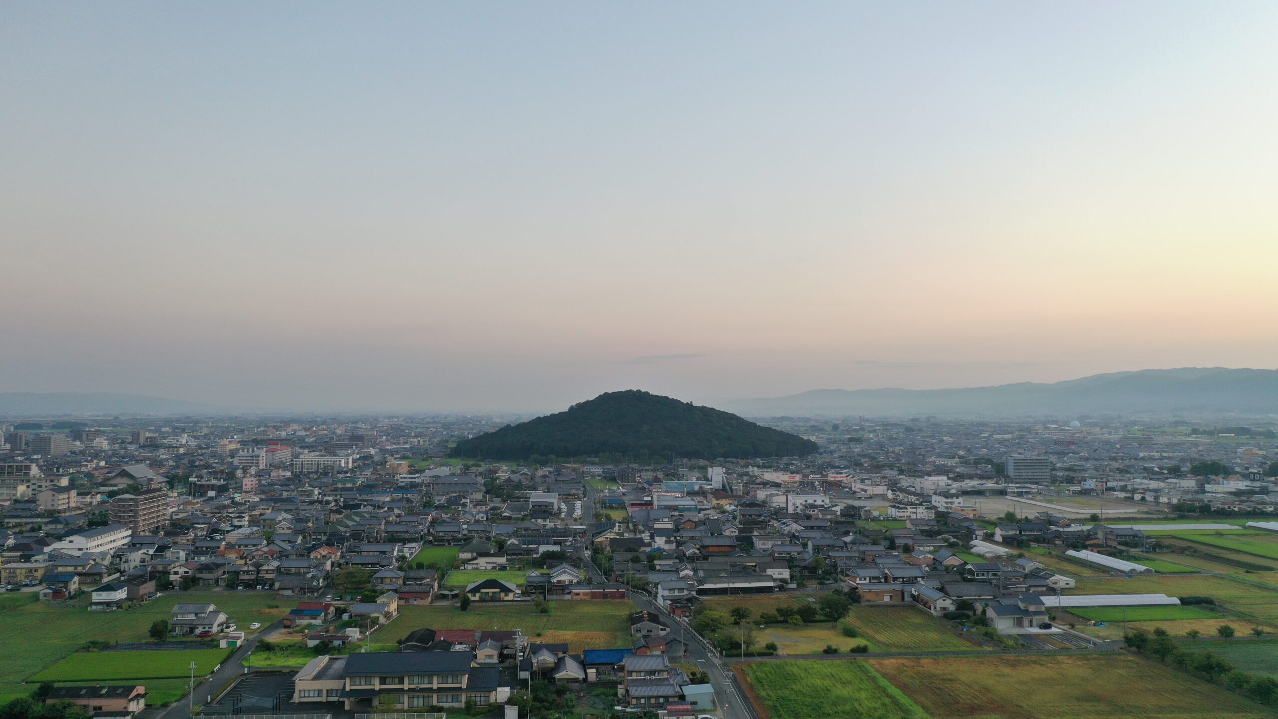
14 Three Mountains of Yamato ( Mt. Kaguyama)
Of the three mountains of Yamato that played an important role in determining the location of Fujiwara Palace, Mt. Kaguyama was regarded as particularly sacred by the ancient people, based on the idea of sanzan chingo (protection of the three mountains), which was carried over into the palace construction philosophy of later generations. Mt.Kaguyama is an independent hill formed by repeated weathering and erosion of a ridge extending from the Tōnomine Mountains. At the southern foot of the mountain is the Asuka basin, where the Asuka Palace ruins and Asuka Temple ruins are located. In the Kojiki (Records of Ancient Matters), Nihonshoki (Chronicles of Japan), and Man’yoshu (Anthology of Myriad Leaves), the mountain was called “Ama-no-kaguyama” and recognized as a special mountain directly connected to the heavens. It is also the setting of the famous myth of Ama-no-Iwato. In the Manyoshu, Emperor Jomei (husband of Emperor Saimei and father of Emperors Tenchi and Temmu) composed a Japanese poem about seeing the country from Mt. Kaguyama and congratulating himself on his prosperity.
15 Three Mountains of Yamato (Mt.Unebiyama)
- 所在地
- Jimyoji-cho, Otani-machi, Yamamoto-machi, Okubo-machi, Yoshida-machi, Unebi-machi, Kashihara City
- 指定年月日
- July 14, 2005 (scenic beauty)
- 航空写真で見る
- Mt.Unebiyama
It is the highest of the three mountains (199.2 m above sea level) and is located west of the Fujiwara Palace, which played an important role in determining the location of the Fujiwara Palace according to the idea of the three mountains’ protection, which was carried over into the palace construction philosophy of later generations. The mountain has strong ties to the mythology of the founding of Japan, as the Kashihara Palace of Emperor Jinmu and the Mausoleum of Emperor Jinmu were built in the surrounding area.
16 Three Mountains of Yamato (Mt. Miminashiyama)
Located north of Fujiwara Palace, one of the three mountains of Yamato that played an important role in determining the location of Fujiwara Palace according to the idea of the protection of the three mountains, which was carried over into the palace construction philosophy of later generations. The lowest of the three mountains (139.7 m above sea level), it has a beautiful conical shape.
Buddhist Temple Site
05 Asuka-dera Temple Site
The Asuka-dera Temple Site is the remains of Japan’s first Buddhist temple with a full-scale temple complex (completed in 596). It is in the Asuka Basin, to the north of the Asuka Palace Site. The site consists of the remains of the temple site (remains and artifacts) buried underground in good condition, the base of Chukon-do Hall, the platform of the seated statue of Shakyamuni Buddha (Asuka Daibutsu) that was placed in Chukon-do Hall, the foundation stones of Chukon-do Hall and the lecture hall, etc. that are exposed above the ground. International exchange in East Asia brought Buddhism to Japan via China and the Korean peninsula. Buddhism and Buddhist temples played an important role in the development of the ancient Japanese nation.
It is believed that Buddhism was introduced to Japan in the mid-6th century. Half a century later, Asuka-dera Temple, Japan’s first temple with a kondo (main hall), a lecture hall, a pagoda, and a cloister, was built in Asuka. In addition to the Chinese characters essential for sutras, Buddhist temples included the latest technologies in civil engineering, architecture, surveying, roofing, and metalworking. These knowledge and technologies introduced from China and the Korean peninsula became the foundation of Japan’s nation-building. The construction of temples was largely the result of the efforts of immigrants from the Korean Peninsula, students returning from China, and learned monks. The layout of the temple complex and the types of roof tiles excavated at the site provide a glimpse of the international exchange with East Asian countries and regions.
06 Tachibana-dera Temple Site
Tachibana-dera Temple Site is the site of a nunnery that was built in the early 7th century and adopted the Baekje style of temple architecture. The temple site is located at the southern end of the Asuka Basin. The Kawahara-dera Temple site is located next to the temple to the north and is known to be one of the oldest nunnery sites in Japan, based on the descriptions in written documents and excavation surveys. Based on excavated tiles and other evidence, it is believed to have been founded in the early 7th century. Although the temple was destroyed by fire twice, it has been repaired and rebuilt, and is now used as a monastery.
07 Yamada-dera Temple Site
- 所在地
- Oaza Yamada, Sakurai City
- 指定年月日
-
March 3, 1921 (Historic Site)
March 3, 1952 (Special Historic Site)
- 航空写真で見る
- Google Maps
The Yamada-dera Temple Site was built in the middle of the 7th century by Sogano-Kurayamada Ishikawamaro, a member of the powerful Soga clan. 649, Ishikawamaro was suspected of treason and committed suicide at the Yamada-dera temple. The temple was completed around 685 with the help of his grandson, Princess Uno-no Sarara (later Empress Jito). Yamada-dera Temple has a central gate, a pagoda, a main hall, and a lecture hall in a straight line, a layout similar to that of temples in the Baekje period. After the capital was moved to Heijo-kyo, Yamada-dera Temple continued to flourish, and even Fujiwara no Michinaga is said to have admired its magnificent temple complex. Later, in the late Heian period (794-1185), many buildings were lost due to disasters. Among them, the eastern corridor has been excavated in the same condition as when it collapsed, and it conveys an architectural style older than that of Horyu-ji Temple. These building components are on permanent display at the Asuka Museum, Nara National Research Institute for Cultural Properties.
08 Kawara-dera Temple Site
The Kawara-dera Temple Site is the remain of a Buddhist temple built by Emperor Tenji in the mid-7th century for his late mother, Empress Saimei, on the site of the late Kawahara Palace, at the empress’ own initiative. Located on the west side of Asuka Palace, it is a typical example of the relationship between a palace and a temple. Unlike earlier temples imported from the Korean Peninsula, this temple has a one-pagoda, two-kondo style layout, with the Buddhist temple at the center. The scale of the temple construction and the use of senbutsu (stone pillars) to decorate the interior of the hall indicate that it was greatly influenced by the Tang Dynasty in China. During the reign of Emperor Monmu, this temple was ranked as one of the four major temples along with Daikantaiji Temple, Yakushiji Temple, and Asuka-dera Temple, and was treated as a state temple (kan-ji).
09 Hinokuma-dera Temple Site
Hinokuma-dera Temple Site is the site of a Buddhist temple built in the center of the Hinokuma Basin, southwest of Asuka Palace, at the base of a migratory clan. It has a unique layout with the Kondo (main hall) and the lecture hall on the north and south sides of the pagoda, and a corridor extending from the west gate (middle gate) surrounding the Kondo and the lecture hall, and adopting a tiled podium, which is common in temples of the Baekje Dynasty. After the official establishment of Buddhism, the emperor encouraged the construction of temples, and powerful clans began to build their own temples. One of these temples, Hinokuma-dera, is a Buddhist temple that was built by the Eastern Han clan, an influential transplanted clan. The use of a tiled podium, which is common in Baekje temples, on the exterior of the auditorium’s podium indicates that the construction of the temple was promoted by a powerful family with a background of exchange with East Asia.
17 Daikandaiji Temple Site
- 所在地
- Koyama, Asuka Village, Minamiura town, Kashihara City
- 指定年月日
- March 3, 1921 (Historic Site)
- 航空写真で見る
- Google Maps
Daikandaiji Temple Site is the site of a state temple systematically located in the grid-like Jobo on the southeast of Fujiwara Palace. It was the largest temple in Asuka-Fujiwara, and the nine-story pagoda in particular was a national symbol common to East Asian countries (Tang Dynasty, Baekje, Silla, and Koguryo). Excavations that began in 1974 have revealed the remains of a lecture hall, a corridor, and a central gate, as well as the scale of the temple complex. In 711, a major fire destroyed the main temple complex, including the Kondo (main hall), lecture hall, pagoda, central gate, and corridor. At that time, only the Kondo and the lecture hall had been completed, while the pagoda and the middle gate were still under construction. Daikandaiji Temple was relocated in 710 with the relocation of the capital to Heijo-kyo, and continues to carry on the Buddhist lantern as Heijo-kyo Daian-ji Temple. It occupied the position of the nation’s first temple until Emperor Shomu built Todaiji Temple.
18 Motoyakushiji Temple Site
- 所在地
- Kidono town, Kashihara City
- 指定年月日
-
March 3, 1921 (Historic Site)
March 29, 1952 (Special Historic Site)
- 航空写真で見る
- Google Maps
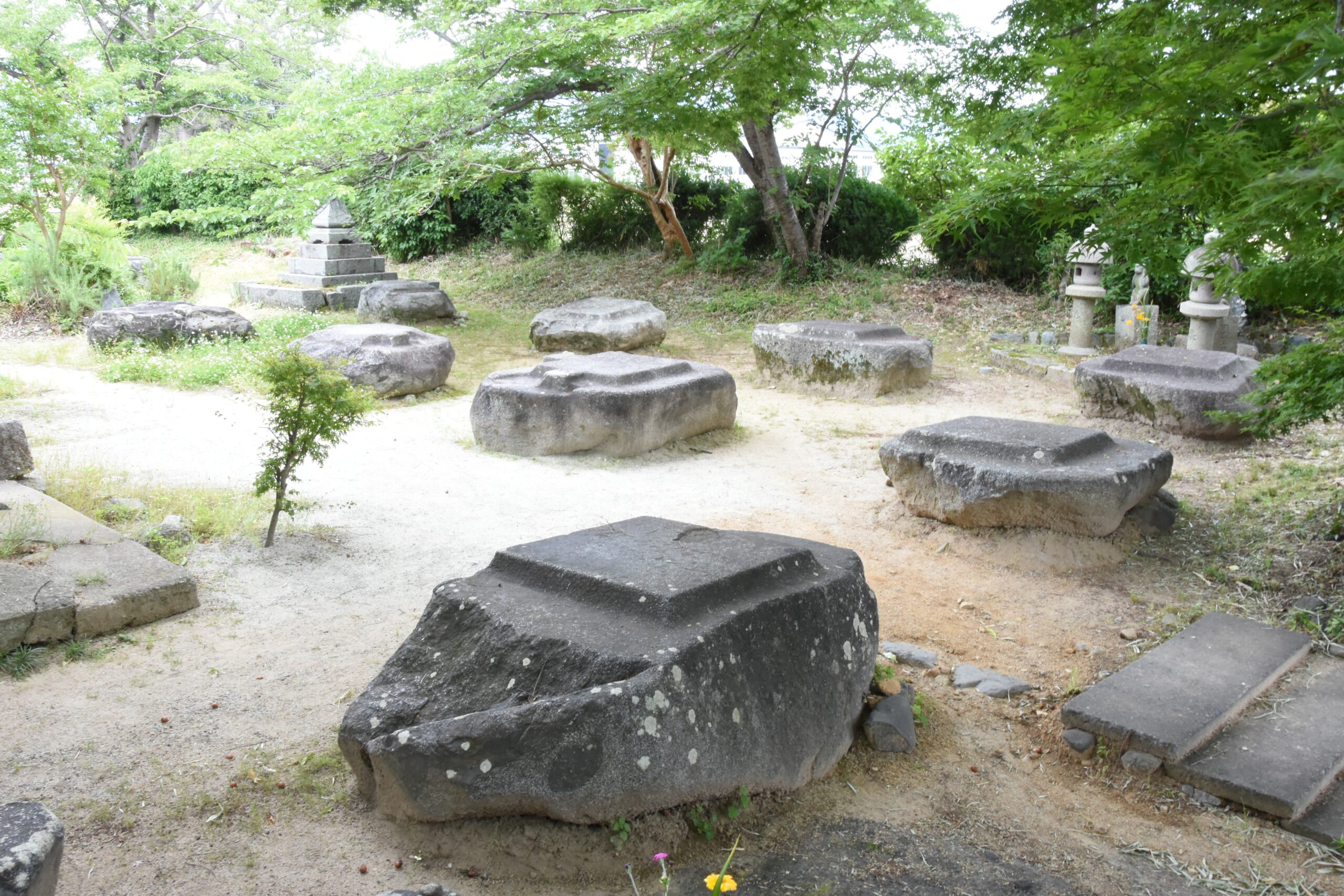
The Motoyakushiji Temple Site is the site of a state temple that was systematically located within the southwestern the grid-like Jobo of Fujiwara-kyo. It is in the village of Kidono-cho, about 500 m east of Kintetsu Unebi Goryomae Station. The remains of the Kondo (main hall), East Pagoda, and West Pagoda platforms are well preserved. At the site of Kondo, where the temple building called Iōin now stands, the foundation stone remains in the same position as it was at that time. The foundation stones and foundation stone of the east and west pagodas remain on the east pagoda platform, and the foundation stone of the west pagoda remains on the west pagoda platform. The layout and scale of the twin-pagoda style temple complex, in which the central gate, Kondo (main hall), and lecture hall were aligned in a straight line from north to south, and the pagoda was aligned east to west between Kondo and the central gate, was also inherited by Yakushiji Temple after the capital was moved to Heijo-kyo in 710.
Mounded Tomb
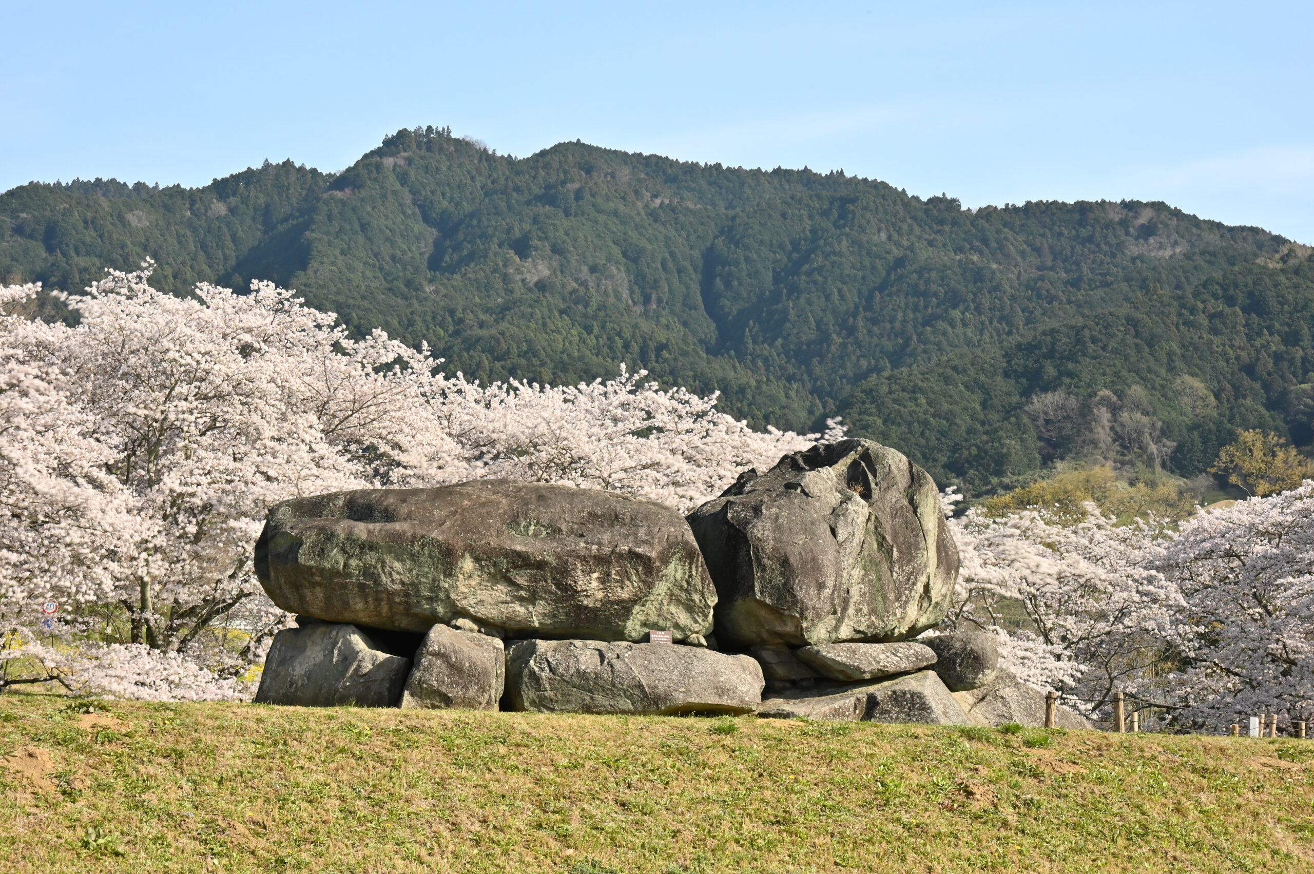
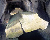
10 Ishibutai Mounded Tomb
- 所在地
- Shima-no sho, Asuka Village
- 指定年月日
-
December 24, 1935 (Historic Site)
March 29, 1952 (Special Historic Site)
- 航空写真で見る
- Google Maps
Ishibutai Mounded Tomb is a square burial mound measuring approximately 50 m on each side located in Shima-no sho, Asuka Village. The upper part of the mound has been lost, exposing the huge ceiling stone of the horizontal stone chamber, which was already known as a tourist attraction in the Edo period (1603-1867). Tuff fragments, believed to be part of a sarcophagus, have been excavated from the stone chamber. When the tomb mound was constructed, the land was cleared by breaking up smaller tombs, and the huge size of the mound indicates that it was the tomb of a person of considerable power. One theory is that this is the tomb of Soga no Umako (died 626), called Momohara no Haka (tomb of Momohara) in the Nihon Shoki (Chronicles of Japan). Ishibutai Mounded Tomb, whose shape and burial facilities are clear, gives a good picture of the tombs of the next generation of powerful people in a large keyhole-shaped tombs.
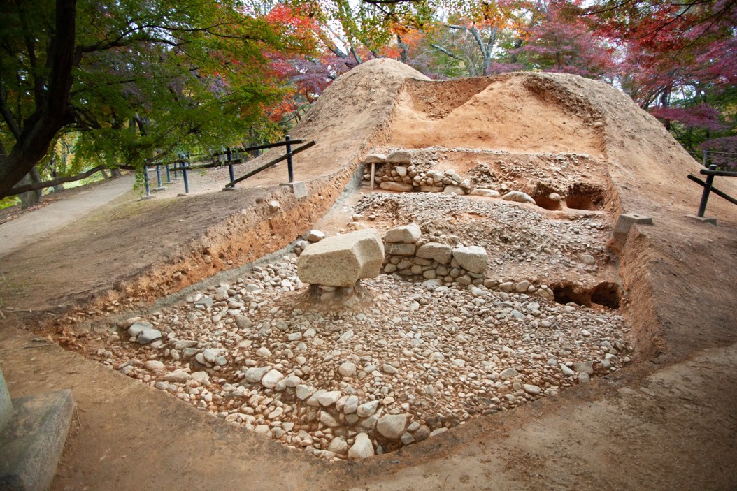
11 Shobuike Mounded Tomb
This tomb was built in the middle of the 7th century on the southern slope of a hill (Amagashi Hill) located in the western direction from the Asuka Basin, where the Asuka Palace Site and other sites are located. It is thought to be the tomb of an influential person because of its square mound shape, which was used in the mausoleums of Chinese emperors. The burial facility follows the Kofun period (tumulus period) style of a horizontal stone chamber, but the mound is smaller than that of Ishibutai Mounded Tomb.
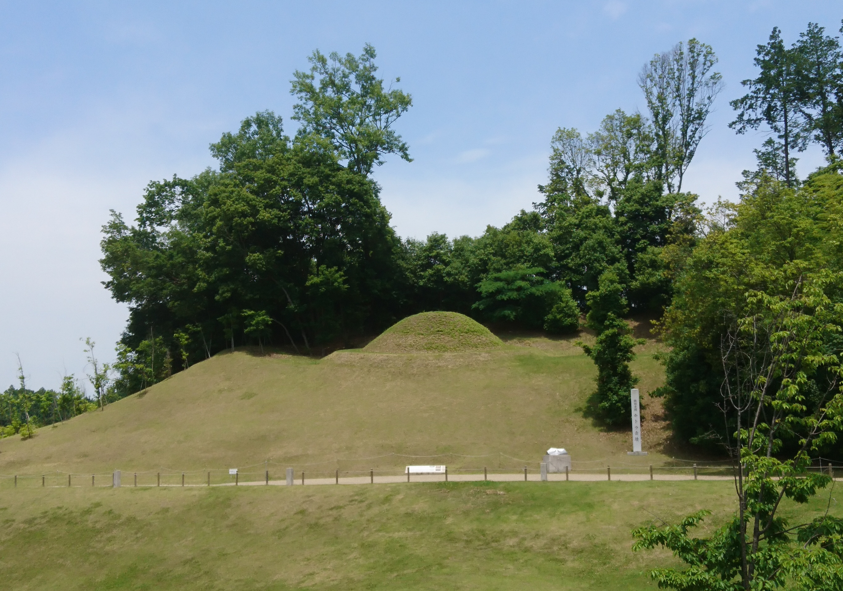
12 Kengoshizuka Mounded Tomb
These tombs were constructed in the late 7th century in the southwest direction from the Asuka Basin, where the Asuka Palace Site and other sites are located. The octagonal burial mounds, based on the Chinese cosmology, were created uniquely in Japan in place of the square burial mounds, with the aim of establishing a centralized state with the emperor at the top. The construction of the tombs was based on continental technology and thought, and the mound form was unique to Japan, making it a tomb like no other in East Asia. The tombs demonstrate a “new authority with the emperor’s mausoleum at the top”.
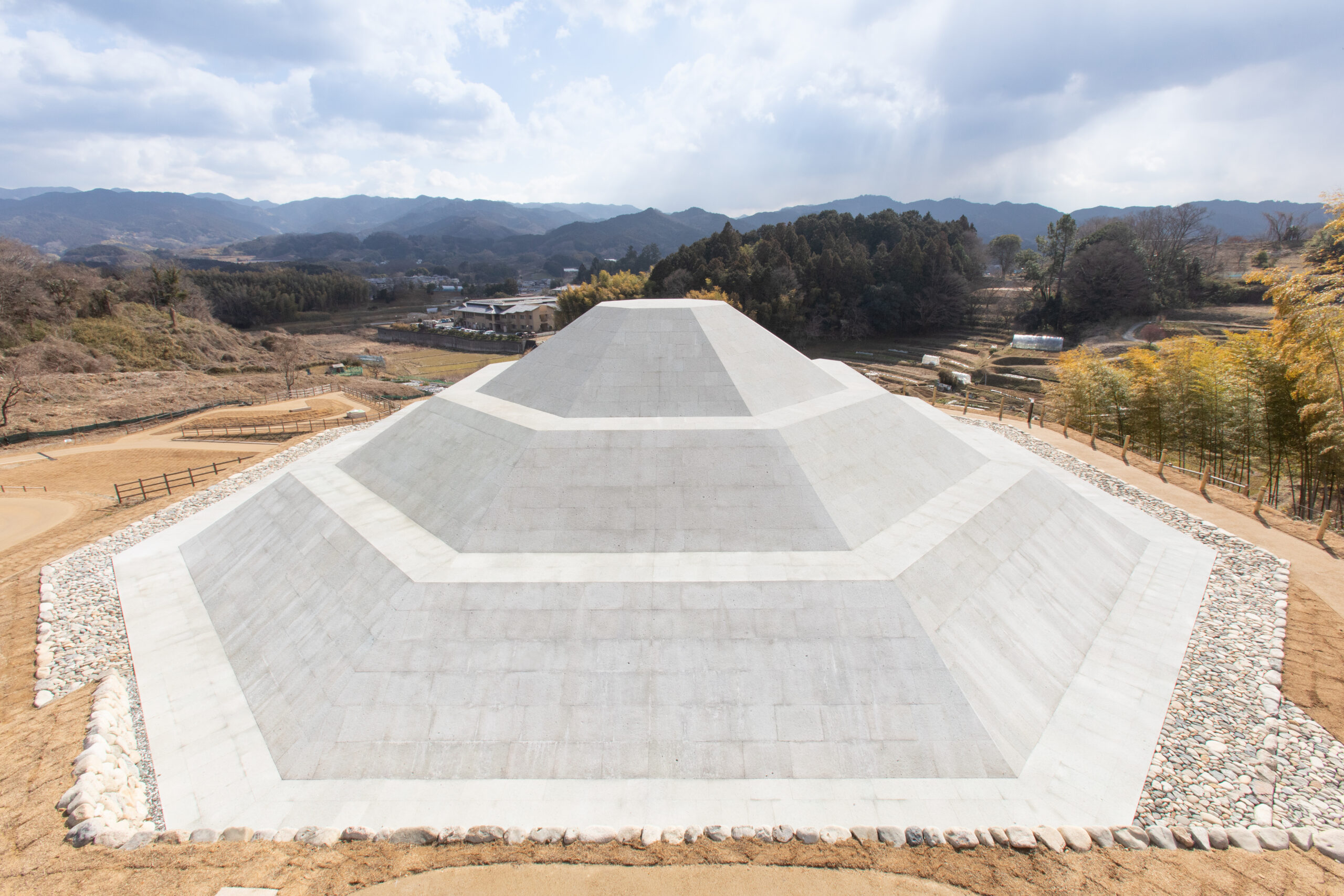
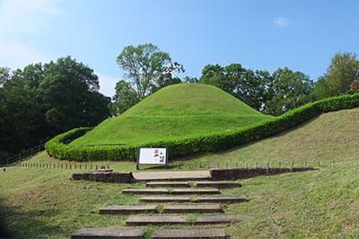
19 Mausoleum of Emperor Temmu and Empress Jito
.jpg)
- 所在地
- Noguchi, Asuka Village
- 指定年月日
- February 1881 (Ruled as the mausoleum of Emperors Temmu and Empress Jito))
- 航空写真で見る
- Google Maps
Built in the late 7th century, this mausoleum is the combined burial place of Emperor Temmu, who planned the construction of the Fujiwara-kyo Capital, and his empress, Jito. The tomb has an octagonal shape, which is said to have been permitted only for the imperial tombs of the Asuka period. It is located directly south of Suzaku-oji Avenue, the central axis of the Fujiwara Palace, indicating that the tomb and palace were constructed as one. Emperor Temmu was buried in the traditional way that had been used since the Kofun period, while Empress Jito’s burial mound contained bone organs, indicating the introduction of Buddhist thought based on cremation, which is consistent with the description of “Hinokuma Ouchi-ryo” in “Shoku-nihongi”.
20 Nakaoyama Mounded Tomb
- 所在地
- Hirata, Asuka Village
- 指定年月日
- April 8, 1927 (Historic Site)
- 航空写真で見る
- Google Maps
- Webサイト
- Nakaoyama Mounded Tomb
Nakaoyama Mounded Tomb is a burial mound located in Hirata, Asuka Village. It is located to the north of the Takamatsuzuka Mounded Tomb, which is famous for its mural paintings. Excavations in 2020 confirmed that it was an octagonal burial mound with a small stone chamber. The possibility that this is the mausoleum of Emperor Monmu has been pointed out based on the condition that it is an octagonal burial mound, which is positioned at the highest level, and that it is a single burial with cremation. The mound has a unique shape, with the first and second levels piled with stones in the form of a platform and the third level filled with earth, and together with the cremation, it is believed to have a strong Buddhist element. This is the final stage of the burial mounds that have been in existence since the Kofun period.
21 Kitora Mounded Tomb
- 所在地
- Abeyama, Asuka Village
- 指定年月日
-
July 31, 2000 (Historic Site)
November 24, 2000 (Special Historic Site)
- 航空写真で見る
- Google Maps
Built in the late 7th or early 8th century, this mural tomb is in the southern tomb area of the Fujiwara Palace. It is the oldest existing astronomical chart in East Asia, which modern astronomy has shown to have been observed in China. The mound was built in layers (known as the “plate construction technique”), indicating the influence of civil engineering techniques from China and Korea. In addition to the astronomical paintings, wall paintings depicting the four gods, the twelve signs of the Chinese zodiac, and the sun and moon have been temporarily removed for conservation and repair, and are now under strict safekeeping.
22 Takamatsuzuka Mounded Tomb
- 所在地
- Hirata, Asuka Village
- 指定年月日
-
June 17, 1972 (Historic Site)
April 23, 1973 (Special Historic Site)
- 航空写真で見る
- Google Maps
- Webサイト
- Takamatsuzuka Mounded Tomb
Built in the late 7th or early 8th century, this mural tomb is in the southern tomb area of the Fujiwara Palace. The tomb is designated as a national special historic site and the mural paintings as national treasures. The murals depict groups of male and female figures, the four deities, and starry constellations based on traditional Chinese thought, showing the influence of the Koguryo and Tang Dynasty. The women’s group painted on the west wall of the stone chamber was deteriorated by environmental changes, including mold growth, but was restored after about 12 years of repair work and is positioned as a symbolic presence for the protection of cultural assets.